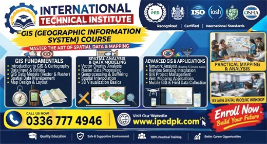
Course Overview
The GIS Course in Rawalpindi & Islamabad at International Technical Institute is tailored for students, engineers, and professionals looking to master Geographic Information Systems (GIS), Remote Sensing, and spatial data visualization. In urban planning, environmental monitoring, civil engineering, disaster management, and telecommunications, skilled GIS analysts are in high demand to convert complex spatial data into actionable intelligence.
This program covers fundamental cartography, coordinate reference systems (CRS), vector and raster data analysis, geoprocessing, and practical map generation using modern software tools.
What You Will Learn
- Introduction to Geographic Information Systems (GIS) and Mapping Concepts
- Coordinate Systems, Projections, and Georeferencing Spatial Data
- Working with ArcGIS Pro & QGIS (Vector & Raster Data Management)
- Spatial Analysis, Buffer Creation, Overlay Analysis, and Interpolation
- Remote Sensing Principles and Satellite Imagery Interpretation
- Global Positioning Systems (GPS) Integration and Field Data Collection
- Digital Elevation Models (DEM) and Terrain Analysis
- Map Layout Design, Cartography, and Professional Reporting
Career Opportunities & Job Roles
Certified GIS professionals are heavily recruited by government agencies, municipal corporations, GIS mapping firms, telecom companies, and international NGOs across Pakistan and overseas. Key roles include:
Why Choose Our GIS Course in Rawalpindi & Islamabad?
As a leading GIS and Remote Sensing training institute in Pakistan, International Technical Institute offers comprehensive practical lab sessions, real-world project work, and professional software guidance. Our curriculum matches the industry standards demanded by major employers.
Whether you want to advance your career locally or explore global job markets in the Middle East and beyond, our specialized certification proves your technical competence in spatial technologies.